
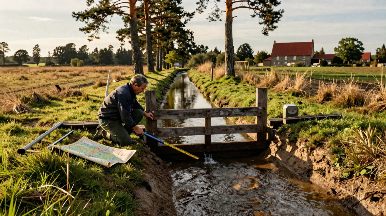
At first light near Sabres, water never lingers for long on the sandy track. It runs into a straight ditch, vanishes beneath pine needles and joins a network that is almost impossible to spot from the road. Older residents still call it “the system”, as though it had always existed. Yet these channels, canals and ditches tell the story of a vast transformation: from 1857 onwards, thousands of kilometres were dug by hand to drain the Landes. A century and a half later, the landscape faces the opposite challenge. Having fought standing water, it must now hold on to every drop of rainfall. The issue becomes increasingly urgent as summers grow longer.
How the Landes learned to drain water away
A few minutes’ walk through some Landes woodland after a shower is enough to reveal how it works: water has barely any opportunity to soak in. It slips into ditches, sometimes an arm’s depth, laid out with striking regularity between plots of pine trees. In the 19th century, that efficiency was seen as a triumph. The Landes were then regarded as a wet, difficult-to-farm territory, crossed by marshy areas where livestock farming and daily life were both restricted. Drainage was intended to make the land productive, improve travel and support a new forestry economy. At the time, no one could have imagined that the water being driven away would one day become so valuable.
The law of 19 June 1857 was a decisive moment. It set out the drainage and cultivation of the Landes de Gascogne while encouraging local authorities to reshape their shared land. Generations of labourers, resin workers, farmers and entrepreneurs then created an enormous network: around 40,000 kilometres of ditches are cited across the Landes forest region. That is the equivalent of travelling around the world. It was all done by hand, with shovels, pickaxes and a level of endurance that is hard to picture today. Maritime pines took hold, tracks became firmer and the open landscape receded. An entire region was reorganised around water moving away quickly.
Here lies the paradox: the network designed to shield land from excessive damp also speeds up the removal of rainwater. In sandy soil, low in clay and naturally free-draining, every ditch can become a small express route to streams and then waterways. When rainfall is regular, the system appears to operate smoothly. During prolonged dry spells, however, its weaknesses emerge. Groundwater reserves recharge less effectively, wetlands fade away and some watercourses fall earlier in the year. A drop carried off too soon is a drop missing when the heat arrives. This observation does not condemn the history of the Landes; it requires a different way of viewing it.
Retaining rainfall without erasing the Landes landscape
The most practical approach is to slow water down where it already flows. This may involve small wooden weirs, earth plugs, adjustable sluice gates or the selective filling-in of ditches that are no longer needed. The aim is not to flood everything overnight. It is to restore some slowness to a network built for rapid drainage, while taking account of homes, roads, farmland and wildfire risk. In certain areas, restoring a wet hollow or reconnecting an old stream channel can help store water over winter. The ground becomes a kind of sponge again: modest, but useful.
It may be tempting to treat every ditch as an enemy. That would be a mistake, and people living close to these networks understand this well. Many ditches still help keep access routes safe, protect homes or direct water during exceptionally wet periods. Let us be honest: hardly anyone does this every day-checking flows, clearing blockages and adjusting small structures with the seasons. Even so, this local care matters. Successful restoration must be planned with landowners, councils, foresters and nearby residents. It takes time, sometimes compromise and almost always detailed knowledge of the site.
The guiding principle is therefore not “close everything”, but to tailor every intervention to the catchment and the way it is used. As water specialists often put it:
“Retaining water does not mean blocking it; it means giving it time to enter the soil.”
A few practical principles can already inform local projects:
- identify ditches that drain a wetland directly;
- protect ponds, lagoons and valley bottoms;
- install reversible structures before undertaking major changes;
- monitor water levels across several seasons, rather than only after heavy rain.
Behind these technical measures lies one straightforward idea: keep water alive in the landscape, without overlooking the people who work there.
A drainage legacy to repair with care
The Landes have not become dry solely because of their ditches. Climate change, recurring heatwaves, greater evaporation, pressure on resources and changing patterns of use also weigh heavily in the equation. However, the drainage network acts as an amplifier: it turns some intense rainfall into rapid run-off, when soils need time to recharge. We all know that moment after a summer storm when everything looks soaked for an hour, only to become dusty again almost straight away. In the Landes forest region, that impression is far from insignificant.
| Key point | Detail | Benefit for the reader |
|---|---|---|
| A vast historic network | Around 40,000 km of ditches supported the drainage programme launched after the 1857 law. | Understand why water still moves so quickly through many parts of the Landes. |
| A problem that has become paradoxical | Structures created to dry out the soil can reduce rainwater retention and local recharge. | Connect the history of the landscape with the droughts seen today. |
| Gradual solutions | Weirs, plugs, restored ponds and water-level monitoring can slow down flows. | Consider useful action without setting nature, forestry and residents abruptly against one another. |




Comments
No comments yet. Be the first to comment!
Leave a Comment